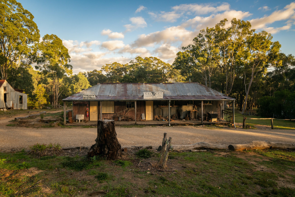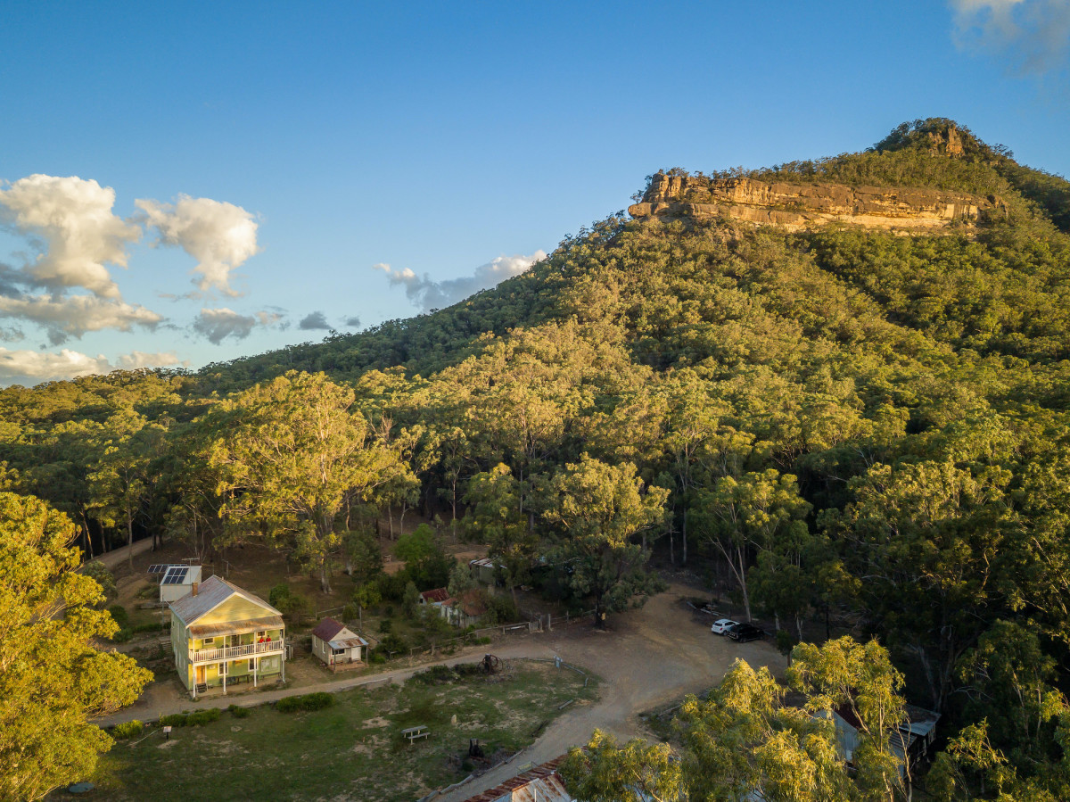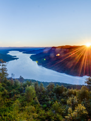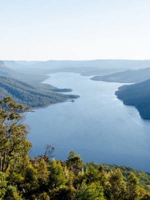
Yerranderie Private Town is one of the most authentically preserved ghost towns in NSW. If your interests lie with history, mining, scenic bush-walking or wildlife this quaint village hidden in the national park has it all.
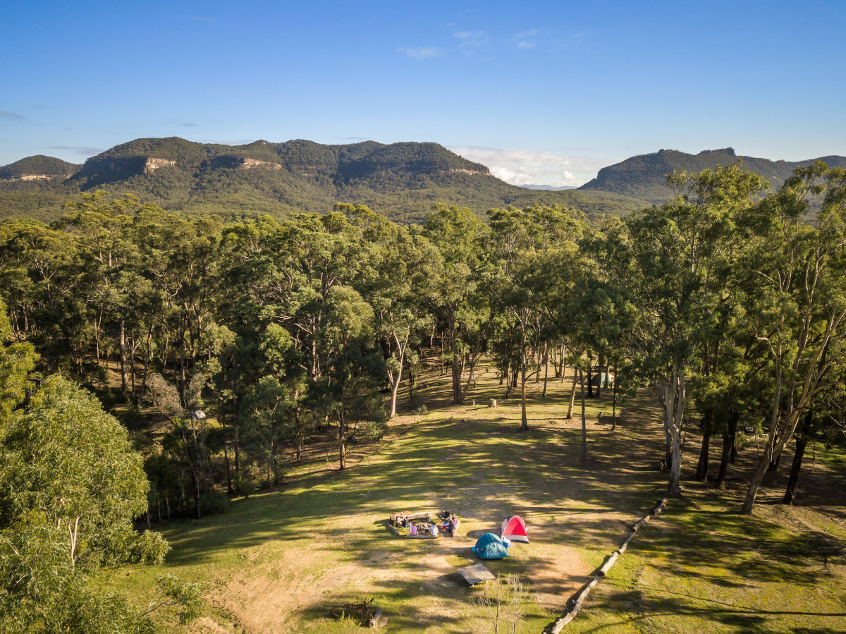
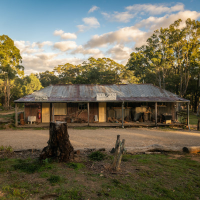
The village can be accessed via the 4 wheel-drive Oberon Colong Stock Route through unsealed trails and wilderness of the Blue Mountains National Park. Taking a walk through the village is reminiscent of its time with a historic post office, tailor shop, general store, bank and residential cottages all restored to their prime condition as accurately as possible. All of the displays featured genuine relics originally collected by miners. The Yerranderie Silver Mine Village also features a free campground for visitors.
Please note there is no immediate access to/from Sydney, only via Goulburn/Oberon areas:
- Please note no access is available from Sydney's west through
Burragorang Valley from East (Picton/Oakdale) and there is no access through the valley from the west, in an easterly direction from Yerranderie - Schedule 1 protected water catchment access restrictions ensure Sydney’s water quality and prevent any access through this area
- Please be aware that many commercially available online mapping and GPS navigation devices do not have this information listed within, and following these without first programming Goulburn or Oberon as an initial destination will cause navigational issues
Safety Alerts: Oberon Colong Stock Route - 4WD only access
- The 4WD Oberon Colong historic stock route to Yerranderie is unsealed road and is only accessible via 4WD vehicles. Recent wet weather has caused slippery conditions with large muddy sections and some deep pot holes which can be challenging to navigate. Some creek crossings may be inaccessible for vehicles with low clearance
- Should you require assistance including towing, emergency services, roadside assistance, please be aware that this is a remote location and it could be extremely challenging to receive support
- Please drive carefully and be aware of road conditions
The History
In 1871 silver ore was discovered at The Peaks, now called Yerranderie and the first applications for leases were applied for in 1885. Mining commenced in 1897 at Bartlett’s Colon Peaks Mine and by late 1899 some 100 men were employed on the silver field. Over the life of mining at Yerranderie, the names of some 50 mines were registered and operated of varying capacity. Sometimes with a change of ownership, the name of the mine changed also. This was the case with Tom Hilder’s Wollondilly Mine which was formerly called Starlight and then the Yerranderie Mine.
Also close by are the silver mining fields of Silver Peak Mine, Colon Peak Mine, Wonga Mine and Wollondilly Mine. A bridge has been installed across the top of one of the large mineshafts on Silver Peak mine allowing visitors to overlook directly into the mining area.
Surrounding Wildlife
The ornate village is also a great spot to come across Australian wildlife as the location is set within a large natural sanctuary of grey kangaroos, wombats, wallabies, wallaroos and mountain birds.
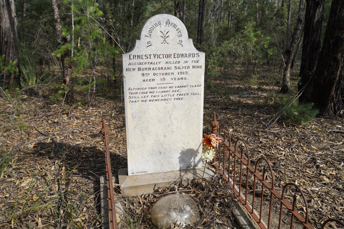
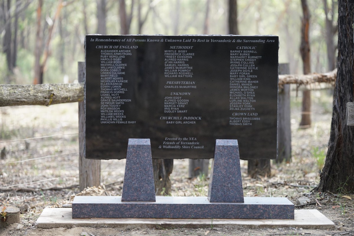
The Cemetery
Close to the village lies the Yerranderie Cemetery. In 1906 the cemetery was allotted with an area of 10 acres 1 rod in the denominations Church of England, Presbyterian, Methodist and Roman Catholic. The remoteness of Yerranderie combined with the availability of only basic medicine, silver mine fatalities, childhood illnesses and plague all took their toll on this community. In the ensuing years there were many burials in the cemetery and wandering through one can’t help noticing the number of small graves of children. The cemetery is located in a bush setting about 2 kilometres from the main intersection as you enter Yerranderie.